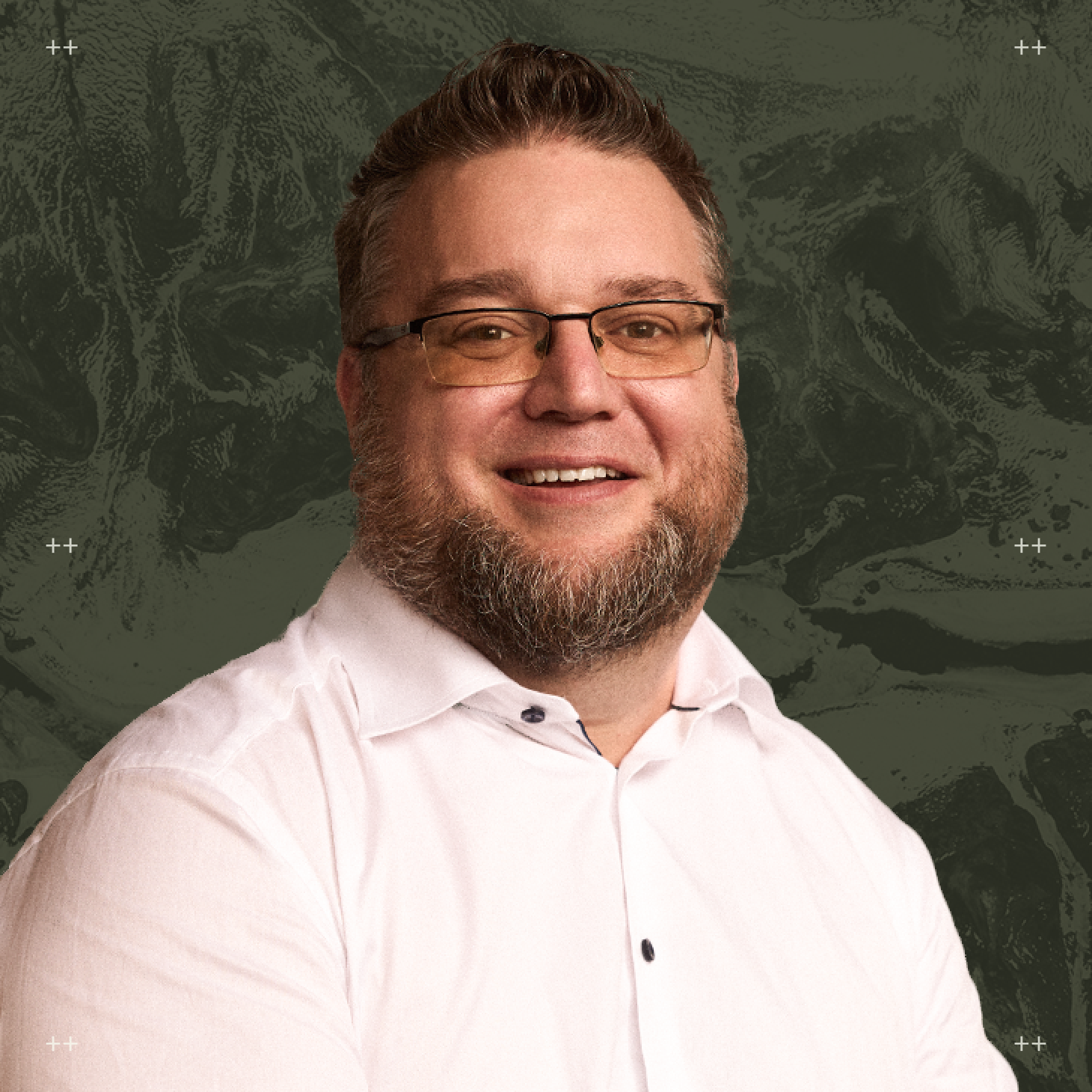
“At the end of the day, every geological target is just data with gaps, and the goal is to recognize the patterns that actually matter,” says Darcy Vis, CEO of Tripoint Geological Services.
As a consulting geologist working across multiple companies, commodities, and datasets, Darcy brings a perspective that is broad and deeply analytical. Operating outside the confines of a single project or set of assets, he evaluates projects through a comparative lens shaped by both present-day exploration and the historical decisions that have defined each project over time.
That perspective has led to a more critical and disciplined approach. Rather than relying on inherited interpretations, Darcy focuses on fundamentals and asking unbiased questions to cut through the noise. Working across varied data has also reinforced the importance of data quality and organization, particularly as new technologies are introduced into exploration workflows.
In our conversation, Darcy explains how consulting has sharpened his ability to build focused target models under tight timelines. He also shares where he sees AI delivering the most immediate value in organizing and interpreting complex datasets, and how tools like VRIFY Predict’s DORA are helping surface new targets while challenging his own assumptions.
5 QUESTIONS WITH AN EXPLORATION LEADER
1. As a consulting geologist working with multiple companies and datasets, you see exploration from a different angle than many in-house teams. How does that perspective shape the way you approach evaluating new targets or opportunities?
Darcy Vis: I have become much more critical of data, and even more skeptical of interpretation. Working on so many projects I have seen not only how things are currently, but also how things have been done on each project in the past. There is a lot of good work happening right now but being independent can definitely improve clarity. I can dig into the question and really strip things down to the fundamentals: is this a good target/project? Does it have economic grade potential? Does it have volume potential? Does it have good infrastructure? Where is it in the development stage and what work will give the best value? Despite the benefit of clarity, there is one clear challenge in being a consultant team and that is everything has to be done quickly; but like every challenge it has sharpened our abilities. Having constraints forces me and my team at Tripoint Geological to build concentrated target models, identify where more data is needed, and determine how we can utilize every ounce of the data we have. At the end of the day every geological target is just a bunch of data points (sometimes with significant information gaps), and all I really do is complex pattern recognition to find the best targets, followed by fieldwork to get more data points.
2. From your perspective, where does AI add the most value when evaluating exploration data? How does this impact your workflow and what are the advantages you’ve experienced?
DV: The biggest impact I currently see AI making is that it forces companies to organize their historical datasets, as well as encourages them to collect better data. It's amazing what you can find if you just look, and being organized makes looking much easier. As we move forward with modern data collection and organization, the impact of this benefit will reduce, but currently its value cannot be understated.
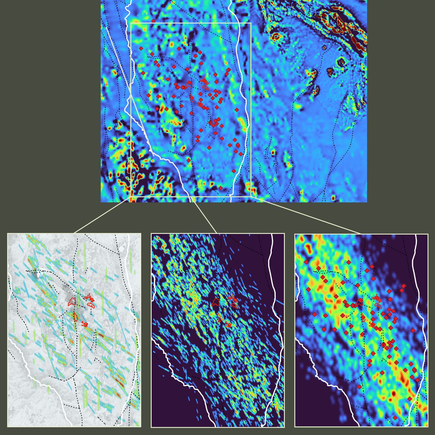
The second biggest value is a computer's ability to retain, process, and visualize data. The human brain is brilliant but there is only so much data you can store and recall, and when visualizing more than five pieces of data it gets confusing — if you have ever seen a map with geology, geophysics, and multiple different geochemical elements, you know what I mean, or even a three-axis data plot. A computer doesn't have this limitation and it can process all of that information rapidly. One thing that humans are traditionally better at than computers is initiative leaps and filling gaps in data, but with the development of AI, this human superiority is narrowing.
I am still old school at heart and will always be thinking about projects from a more traditional standpoint, however the AI workflow can run simultaneously and provides me with supporting evidence, highlights my own biases, and identifies things I may have missed. It's also super fast and can cover large areas and large datasets quickly. Exploration is inherently expensive and anything we can do to improve our efficiency and effectiveness will always be welcome.
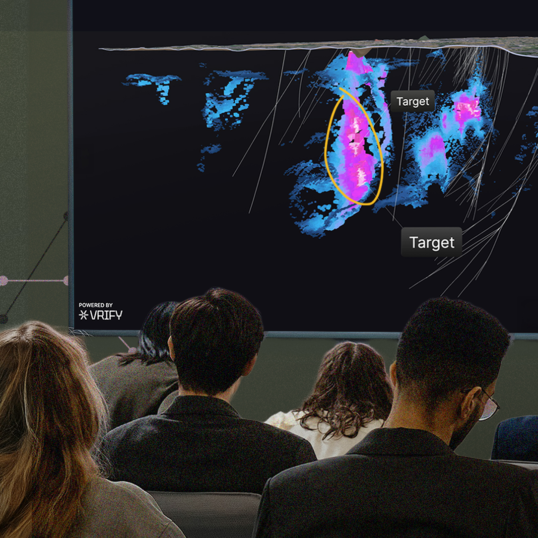
3. What was your first impression when you saw a demo of DORA, and how has your opinion on the software changed over time?
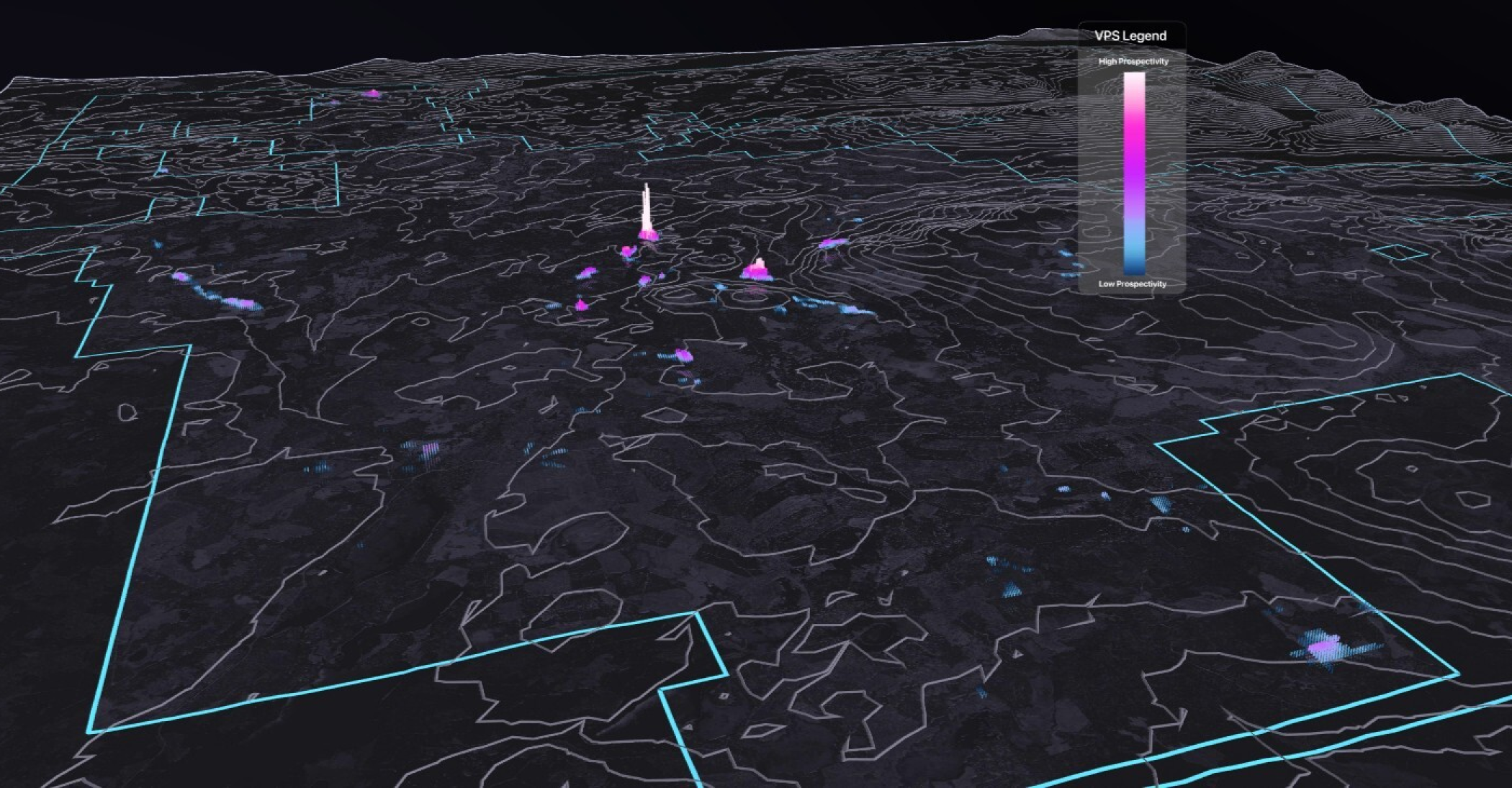
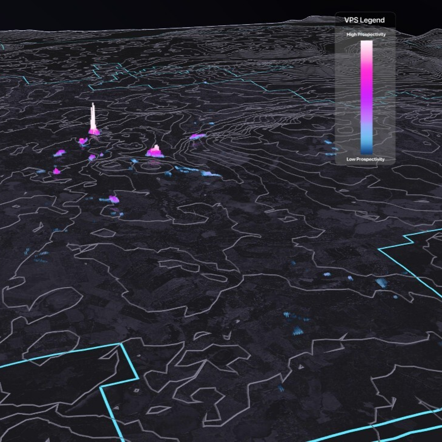
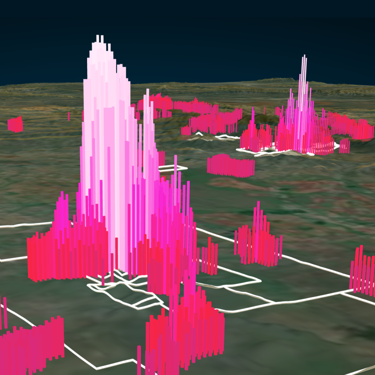
DV: The very first time I saw a DORA demo was at a coffee shop in downtown Victoria, BC. Steve de Jong was turning layers on and off, spinning the prospectivity model and accompanying VRIFY Prospectivity Score (VPS), showing the process all from his tablet. What stood out immediately to me was the ease of use, the focus on breaking things down so it was easy for a human to understand and visualize, and the flexibility to look under the hood of the AI and understand the process. All three of these items were always lacking on many AI offerings I had seen before. Since then, I have used the system quite a few times and I absolutely love the ability to create my own experiments by selecting different datasets, running them against different deposit models, and comparing them to my own knowledge. It's like having a little friend you can bounce ideas off of who is both brilliantly smart, but can also completely forget a group of data if you choose. I always love working with people who have different perspectives than me, and this is another one of those working relationships.
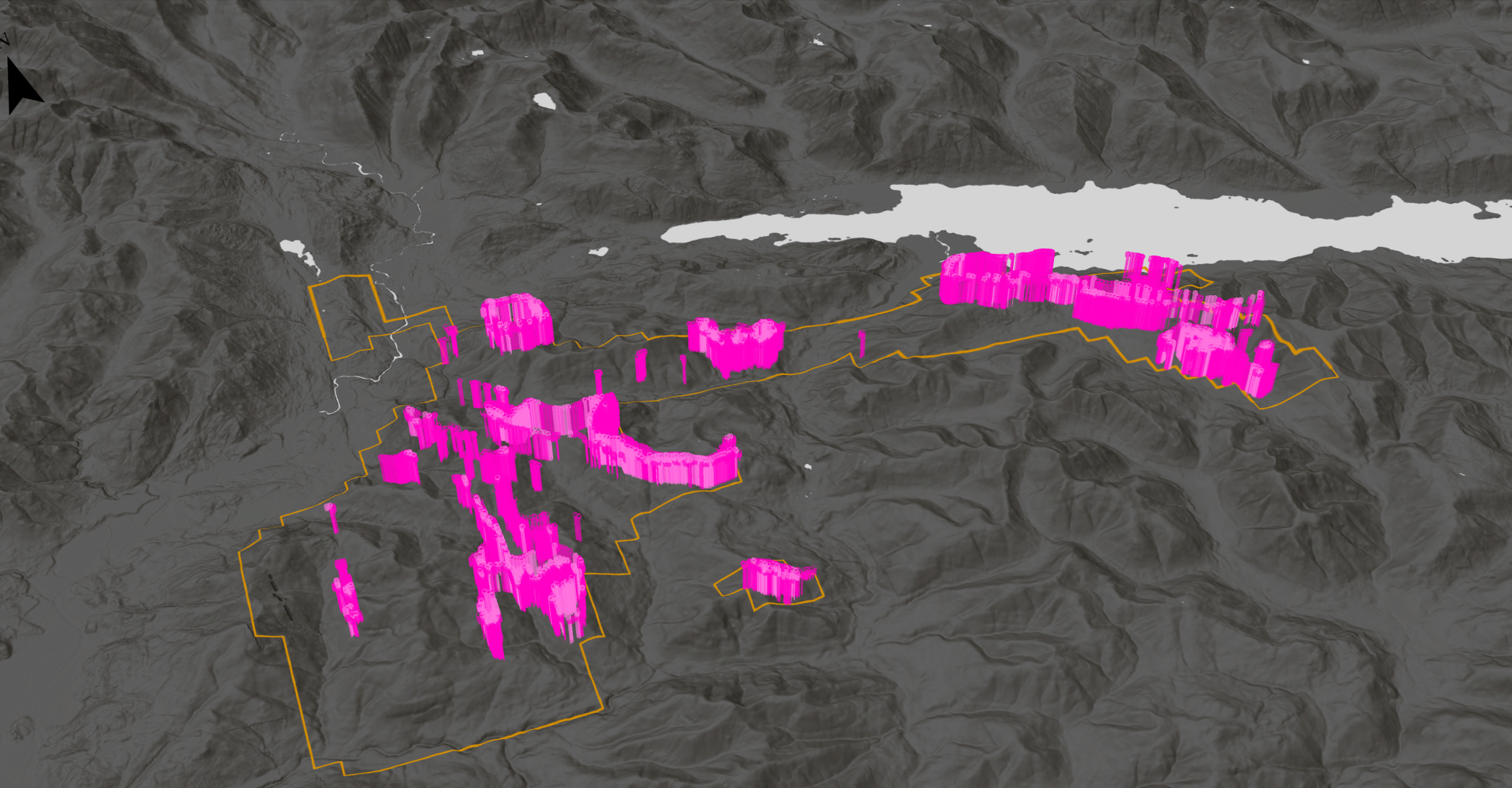
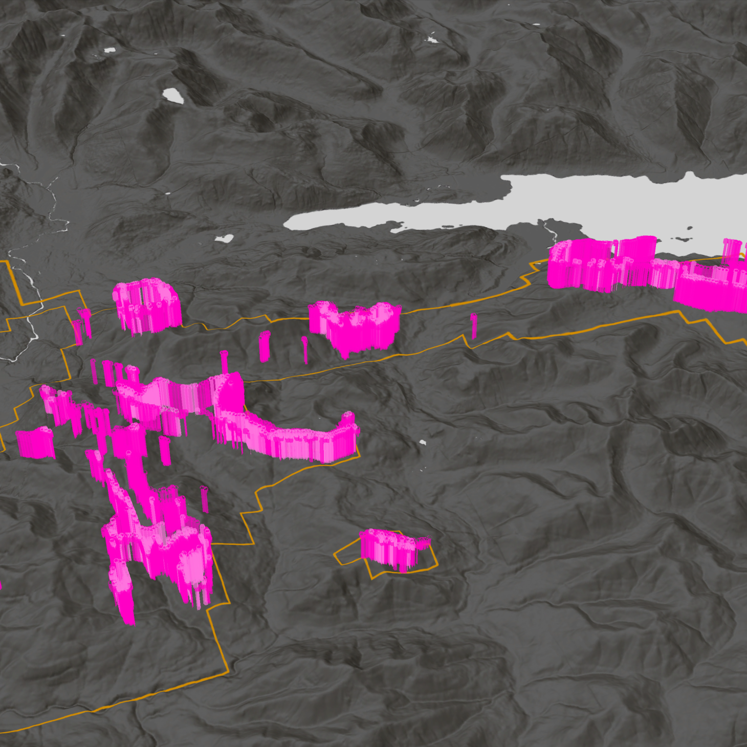
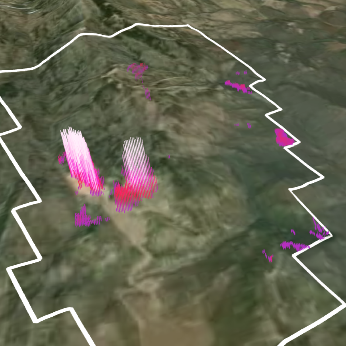
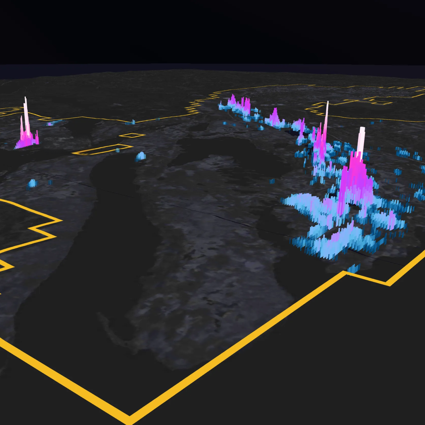
4. You recently shared a story about the “AI 3000 Zone” identified using VRIFY’s DORA software at Cowichan, an area that wasn’t originally on your radar but led to the discovery of altered volcaniclastic tuff similar to mineralization seen at Gold Dyke. What was your reaction when DORA highlighted that target, and what did finding that rock in the field tell you about its potential?
DV: The first time I ran DORA on the Cowichan Project I had no idea what I was doing. That was done on purpose since I knew I would only be completely ignorant once and we wanted the VRIFY team to have my fumbling, intuitive clicking help refine the UI. But through that initial process, and despite my fumbling, DORA identified, with fairly good accuracy, the zones I had already found using my more traditional targeting methods. Beyond that, it even identified areas I had suspected but didn't have any concrete evidence for, which was remarkable. There was one spot that the software highlighted that I didn't know about, or even suspect, an area just off of my mineral claims. Following the DORA processing I immediately staked the area (calling the claim "Are you feeling lucky Steve?" as a light hearted and skeptical jab at Steve de Jong) and sent a team up to inspect it. Upon a quick first pass they found favorable clay-sericite alteration similar to what we saw on the more mineralized portions of the property including the Gold Dyke, I called the zone the “AI 3000 Zone” to give credit where credit was due. I didn't think to go up there originally because I thought the rocks were all weathered off below the favorable host lithology. I let my geology bias get in the way, but DORA didn't have such ideas (since I didn't add the geology map to the processing), and it identified it as a good potential target zone. Apparently Steve is lucky and I am excited to go back up there and do some more data collection.
5. Over the course of your career, how has your approach to exploration evolved, and what principles guide the way you evaluate new targets today? Based on this, what advice would you give both experienced geoscientists and those just entering the field?
DV: When I first started I was constantly overwhelmed and felt like I knew absolutely nothing; I thought I would never learn enough to be truly good at geology. Over time, as I started to gain experience, I started recognizing the fundamentals of what controls mineralization and how that displays itself in the rock. Geoscience is so cool since it's a real mixture of science and art. A large part of geology has always been visual identification and artistic interpretation, supported by hard science. Over the course of my career that focus has changed to be more on statistics and mathematics; but the spark which starts the process continues to be human intuition. Every new project I start on starts with the same words: "Where is the data?". Everyone has a slightly different process for targeting (I think it's largely based on training and how each person organizes data in their brain) but for my process I always start with geochemistry, first the certificates looking for element enrichments and depletions, then spatially on GIS. At the beginning I always focus mostly on soil/silt samples and drill core since they tend to have less sampling bias (as long as the core isn't selectively sampled). From there I look at rocks, focusing more on the sample notes and alteration than actual mineralization; trying to separate facts from interpretation. After that it is geophysics and structure, followed by remote sensing. Anyone can identify high copper and gold values in rocks, but it's the nuanced areas of overlapping and supporting data which hold the best potential in my opinion. I not only look for conventional targets but also novel targets people haven't thought of yet. In my opinion that is where AI excels, it thinks differently from humans and it can find zones which a human wouldn't necessarily think of right away.
While I never think of myself as someone who should give advice, I do encourage everyone, no matter the skill level, to keep learning, keep questioning, keep challenging yourself — and always think outside the box. Every deposit is unique and often defies conventional wisdom. Seek to understand your known zones, find out what makes them unique, throw every idea at that spot to see what works, and then apply it to the region to find more. Also, despite many years of learning I still often feel overwhelmed and stupid; while it's a good way to keep driving oneself towards deeper learning don't ever let that feeling hold you back from voicing your ideas. Paraphrasing from Socrates: We are all idiots around here.
<hr />
Darcy’s insights reinforce the need for clarity in an industry often shaped by fragmented and complex data. His ability to strip projects back to their core (pun intended), while remaining open to new tools and perspectives, reflects a disciplined approach that is both practical and forward-looking.
As exploration continues to evolve, the integration of human expertise with tools like AI will play an increasingly important role in uncovering new opportunities. For Darcy, that balance remains central, grounded in fundamentals, informed by experience, and driven by a continuous effort to better understand what the data is revealing.
VRIFY's DORA software is a good balance between a high-tech complex processing backend and an easy to run, easy to understand frontend, which is a really tough balance to achieve. It also does what it does well, and focuses on that task without overstepping its scope, which again is a tough thing to achieve. From the user side I appreciate the ability to control certain steps of the process, if desired, as well as its processing transparency. Overall it feels like the software focuses on two questions: where are we? and where do we go from here? Those two questions give it clarity of purpose, and make it incredibly useful for us explorationists since those are the questions I ask as well. I am excited to see how it continues to develop and enhances its answers to those questions.
Darcy Vis, CEO of Tripoint Geological Services
<hr />
To see how DORA can support mineral exploration strategy no matter the size of the project or asset, book a demo.

.png)